GNSS
Fiber
Optic
Gyroscope
Inertial
Navigation
System
RTK
for
Marine
Navigation
Key
Specifications
|
Attribute
|
Value
|
|
Heading
accuracy
|
0.25°
|
|
Gyro
range
|
±500°/s
|
|
Zero
bias
stability
at
room
temperature
(1
Sigma
10s
smooth)
|
≤0.11°/h
|
|
Zero-bias
repeatability
at
room-temperature
(1
Sigma)
|
≤0.05°/h
|
|
Acc
range
|
±20g
|
|
Acc
Zero
bias
stability
at
room
temperature
(1
Sigma
10s
smoothing)
|
0.02mg
|
|
Bias
stability
@10s
|
≤200ug
|
|
Weight
|
≤800g
|
High
Performance
MEMS
Inertial
Measurement
Unit
![GNSS Fiber Optic Gyroscope Inertial Navigation System]()
The
inertial
navigation
system
is
designed
for
installation
on
various
carriers
to
provide
precise
angular
rate
and
linear
rate
information,
along
with
comprehensive
navigation
data
including
angle,
speed,
and
position.
System
Features
-
Outputs
high-speed
carrier
motion
angular
velocity
and
linear
velocity
data
-
Supports
initial
alignment
configuration
-
Capable
of
inertial
navigation
and
integrated
navigation
-
Comprehensive
self-test
and
debugging
functions
with
fault
module
identification
-
Features
test/maintenance
interfaces
for
software
upgrades
and
parameter
output
-
Supports
online
serial
port
upgrades
Technical
Specifications
Angular
Rate
Measurement
Accuracy
-
Measurement
range:
±500°/s
-
Zero
bias
stability:
≤0.11°/h
at
room
temperature
-
Zero
bias
stability:
≤0.13°/h
at
high/low
temperature
-
Zero-bias
repeatability:
≤0.05°/h
-
Scale
factor
non-linearity:
≤20ppm
-
Scale
factor
repeatability:
≤20ppm
-
Gyro
bandwidth:
200Hz
-
Startup
time:
10s
Linear
Velocity
Measurement
Accuracy
-
Measurement
range:
±20g
(optional
50g
version
available)
-
Zero
bias
stability:
≤200ug
-
Zero-bias
repeatability:
≤200ug
-
Startup
time:
10s
Initial
Alignment
Accuracy
-
Supports
multiple
alignment
modes:
rocking
base,
mooring
system,
satellite-assisted,
odometer/DVL-assisted
-
Heading
accuracy:
0.25°*SecL
(L
=
local
latitude)
-
Pitch
accuracy:
0.02°
-
Roll
accuracy:
0.02°
-
Alignment
time:
5min
(10min
recommended
for
mooring
systems)
Pure
Inertial
Navigation
Performance
-
Heading
drift
accuracy:
0.12°/h
-
Pitch
drift
accuracy:
0.1°/h
-
Roll
drift
accuracy:
0.1°/h
-
Heading
measurement
range:
0°-360°
-
Pitch
measurement
range:
-90°
to
+90°
-
Roll
measurement
range:
-180°
to
+180°
-
Integrated
navigation
positioning
accuracy:
0.6%D
(D
=
driving
distance)
Satellite
Integrated
Navigation
-
Heading
accuracy:
0.08°
(1σ)
-
Pitch
accuracy:
0.05°
(1σ)
-
Roll
accuracy:
0.05°
(1σ)
-
Horizontal
positioning
accuracy:
1.5m
(1σ)
-
Elevation
positioning
accuracy:
2.0m
(1σ)
-
Supports
RTCM3.X
data
for
RTK
operation
-
Compatible
with
dual-antenna
directional
systems
-
Supports
DVL
and
odometer
integration
Power
Requirements
External
DC
power
supply:
9V-36V
(28V
recommended),
steady
state
power
consumption
≤9W.
Environmental
Specifications
-
Operating
temperature:
-40℃
to
+60℃
-
Storage
temperature:
-45℃
to
+65℃
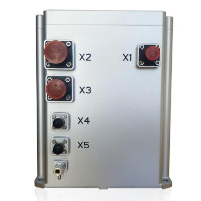
Product
Diagram
![GNSS Fiber Optic Gyroscope outline drawing]()